Why Dieng
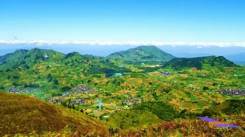
Dieng is said to come from di hyang, "the abode of the gods". The name suits this plateau perched at 2,000 m in the heart of Central Java, where in a single day you find bubbling craters, pools of grey mud, emerald and turquoise lakes, fumaroles among the potato fields, and the oldest Hindu temples in Java, built in the 8th century.
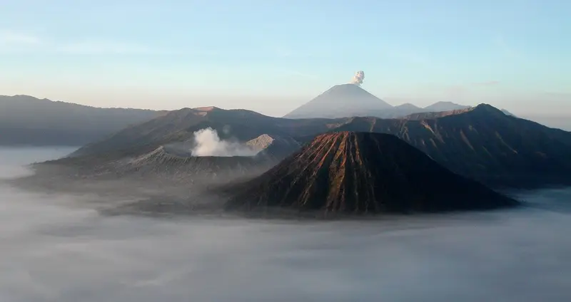
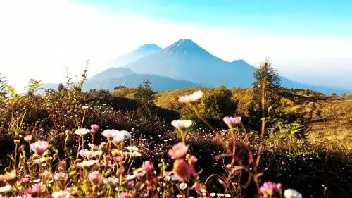
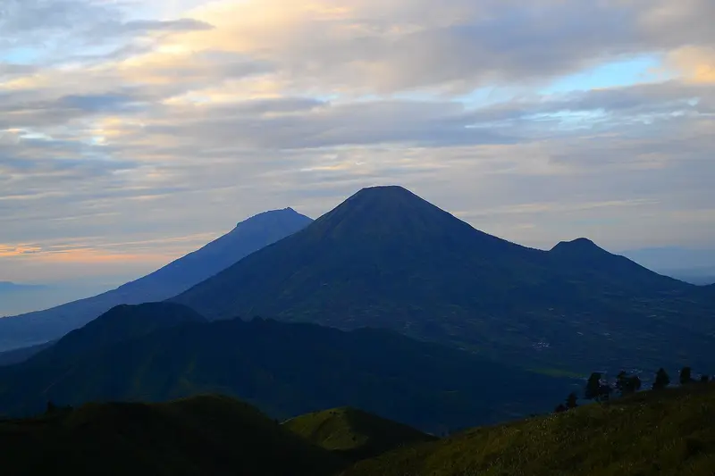
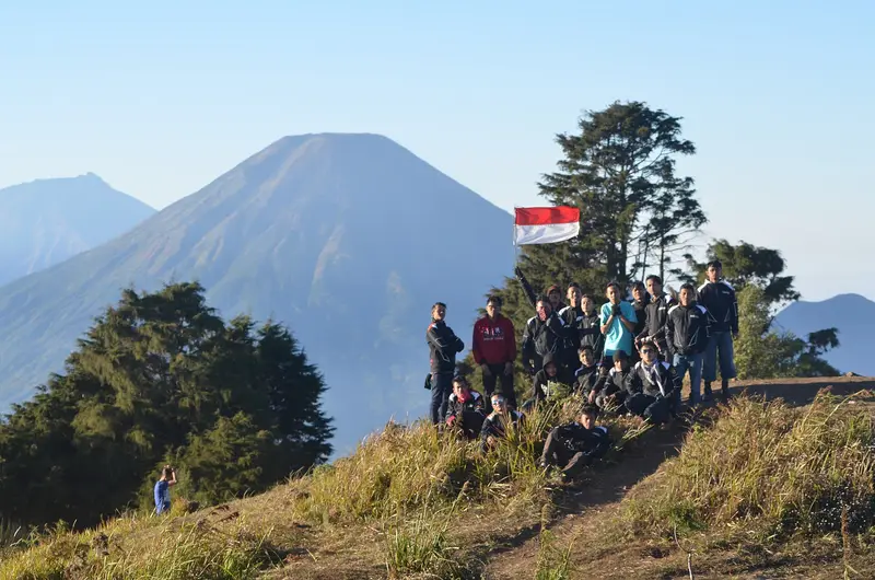
Above the plateau, Mount Prau (2,565 m) is climbed in two to three hours. Its summit, a long grassy ridge of rounded hills, offers one of the most famous sunrises in Indonesia: Sindoro and Sumbing right opposite, and behind them Merbabu, Merapi, Lawu and Slamet.
Dieng is within reach of everyone, with children or without training. But it is also a place where the volcano kills silently, with its gases. Here you learn to respect volcanoes in a different way.
Dieng at a glance
| Elevation | Plateau around 2,000 m; Prau 2,565 m |
|---|---|
| Type | Volcanic complex of 6 × 14 km: stratovolcanoes, about twenty craters and cones |
| Activity | Phreatic eruptions and toxic gas emissions (CO2, H2S) |
| Eruptions | 33 recorded; the latest in 2024-2025 at Sileri crater |
| Main craters | Sikidang, Sileri, Timbang, Sinila, Candradimuka |
| Lakes | Telaga Warna, Telaga Pengilon, Telaga Merdada, Telaga Cebong |
| Temples | Arjuna group, Gatotkaca, Bima, Dwarawati (8th-9th centuries) |
| Alert level | I (normal) in November 2026 |
Is Dieng safe today?
The box next to this article gives today's status. The plateau is open to the public, but the PVMBG maintains specific restrictions:
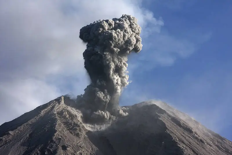
- Sileri crater: do not enter a 200 m radius around its centre and do not camp nearby. Sileri produces sudden phreatic eruptions (2017, 2018, 2021, late 2024-2025).
- Timbang crater: do not enter. It emits carbon dioxide that can flow into the valleys below.
- Other craters: do not enter those where phreatic explosions or high gas concentrations are possible.
The MAGMA report of 15 November 2026 measures 73 °C at Sileri crater and 66 to 78 °C at Timbang crater.
The invisible danger: the Sinila disaster
On 20 February 1979 the Sinila crater had a phreatic eruption. The people of the village of Kepucuk fled along the road past Timbang crater. At the same moment Timbang released a huge volume of carbon dioxide, a gas heavier than air, odourless and invisible, which flowed into the valley. 149 people died of asphyxiation. It is one of the worst volcanic-gas disasters in history.
Since then, Dieng's craters have been monitored continuously, and Timbang's CO2 is measured every day. Remember the lesson: in Dieng, never lie down in a hollow near a crater, do not stay in valley bottoms near Timbang, and respect the forbidden zones.
The sites of the plateau
Sikidang crater
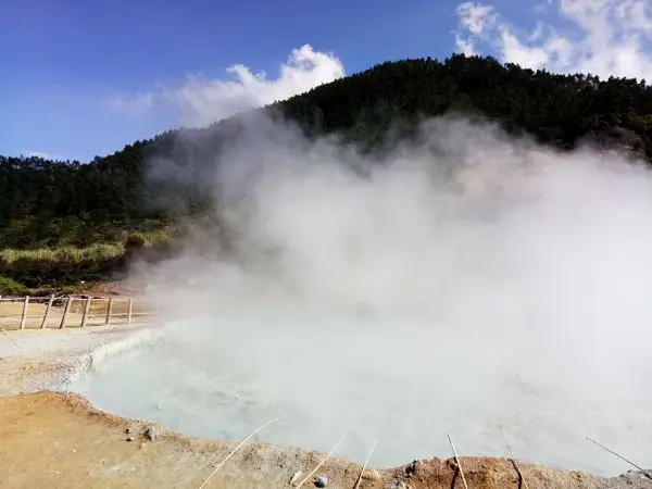
The most visited: a vast hollow of grey and yellow earth where mud and water pools bubble in plumes of steam. The main vent moves over the years, hence its name (kidang, the leaping deer). You walk on wooden boardwalks: do not leave them, the ground can give way over boiling water.
Telaga Warna and Telaga Pengilon
Two lakes side by side. Telaga Warna, the "lake of colours", shifts from green to turquoise with the sun because of suspended sulphur compounds. Telaga Pengilon, the "mirror lake", stays clear. Meditation caves line their shores.
The Arjuna temples
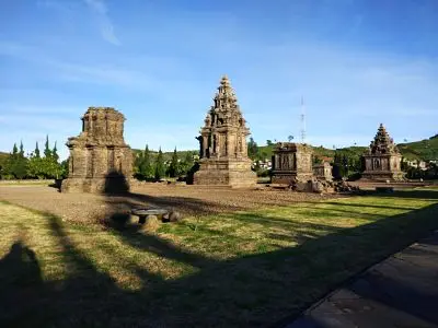
The Arjuna group brings together five Hindu stone temples, built between the late 7th and the 9th century, dedicated to Shiva and later named after the heroes of the Mahabharata. They are the oldest known temples in Java, earlier than Borobudur and Prambanan. Nearby are the temples of Gatotkaca, Bima and Dwarawati.
Sikunir, the golden sunrise
Above Sembungan, the highest village in Java (2,300 m), Sikunir hill offers a sunrise over Lake Cebong and the surrounding volcanoes, after a 30-minute walk. It is Dieng's "golden sunrise". Very busy at weekends.
Climbing Mount Prau
Prau is the remnant of an old stratovolcano, truncated by a large Pleistocene caldera in which the Dieng plateau formed.
- Patak Banteng route, the busiest: 2 to 3 hours of steep climbing on earth steps. You leave around 2 am for sunrise.
- Dieng Kulon, Kalilembu, Wates and Igirmranak routes: gentler or quieter.
The summit is a long ridge of round, grassy hills, sometimes called the "Teletubbies hills", where hundreds of tents go up at weekends. At dawn the view of Sindoro and Sumbing, right opposite, is spectacular. It is close to 0 °C in July–August, and frost can cover the plateau's fields, which locals call embun upas.
You register at the trailhead post and pay a small entrance fee.
Map and GPX track
- Patak Banteng → sommet du PrauDistance 3.3 km · Elevation gain 454 m · Start 2,147 m → High point 2,585 mDownload the GPX track ↓
Indicative route from OpenStreetMap; elevations from Copernicus. Check on the ground and follow your guide. © OpenStreetMap, OpenTopoMap (CC-BY-SA), Open-Meteo.
When to go
- June to September: dry season, clear mornings, freezing nights.
- August: the Dieng Culture Festival and the hair-cutting ceremony for children with matted hair (anak gimbal), a local tradition.
- Rainy season: frequent fog, but the plateau can still be visited.
Getting there
Dieng is about 1 hour from Wonosobo, itself 3 hours from Yogyakarta (bus via Magelang) and 3 to 4 hours from Semarang. The roads are good but winding. You sleep in Dieng village, in simple, cold homestays.
The history of the plateau
Dieng was a major religious centre of the ancient Mataram kingdom in the 7th to 9th centuries. There are thought to have been hundreds of temples here, of which only some remain. The temples were rediscovered by a British soldier in 1814, half drowned in a lake. The Dutch drained the site in the mid-19th century.
The volcano
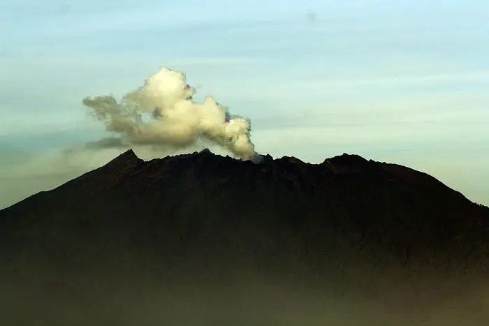
The Dieng volcanic complex covers 6 × 14 km. It includes several stratovolcanoes and more than twenty small Pleistocene and Holocene craters and cones. Prau was truncated by a large caldera, later filled with cones, lava domes and craters, many of them holding lakes. Lava flows cover most of the plateau, but historical activity is limited to small phreatic eruptions, caused by groundwater flashing to steam. Heat flow is high: a geothermal power plant taps the plateau.
The eruptions of Dieng
The Smithsonian records 33 eruptions, most of them very small (VEI 0 to 2), including a stronger one around 1375 at Pakuwaja crater.
1786-1847. Eruptions at Butak Petarangan and Pakuwaja.
1928, 1939, 1944, 1953. Phreatic eruptions in several craters.
1979. The Sinila eruption and the Timbang CO2 disaster: 149 dead.
1986-2021. Repeated small phreatic eruptions, mainly at Sileri (1986, 2003, 2009, 2017, 2018) and Sibanteng (2009).
December 2024 – 2025. A phreatic eruption at the Sileri crater lake.
Full timeline: 33 recorded eruptions
| Start | End | VEI | Location |
|---|---|---|---|
| 2024-12-18 | 2025-01-06 | 1 | Sileri Crater Lake |
| 2021-04-29 | 2021-04-29 | 1 | |
| 2018-04-01 | 2018-04-01 | 1 | Sileri Crater |
| 2017-04-30 | 2017-07-02 | 1 | Sileri Crater |
| 2009-09-27 | 2009-09-27 | 1 | Sileri Crater |
| 2009-01-15 | 2009-01-15 | 1 | Sibanteng crater |
| 2003-07-16 | 2003-07-16 | 1 | Sileri Crater |
| 1996-12-31 | 1996-12-31 | 1 | Near Padangsari crater |
| 1993-01-23 | 1993-01-23 | 1 | Near Pandawa Lima temples |
| 1986-08-06 | 1986-08-06 | 1 | Sileri Crater |
| 1981-07-02 | ? | 1 | Sikidang |
| 1979-02-20 | 1979-02-20 | 1 | Sinila and Sigluduk |
| 1964-12-13 | 1964-12-13 | 1 | Sileri Crater |
| 1956-06-02 | 1956-06-02 | 1 | Sileri Crater |
| 1954-12-06 | 1954-12-06 | 0 | Candradimuka area |
| 1953-03-24 | 1953-03-25 | 2 | |
| 1952-07-16 (uncertain) | ? | 1 | |
| 1944-12-04 | ? | 2 | Sileri Crater |
| 1943-11-03 | ? | 1 | Sileri Crater |
| 1939-10-13 | 1939-10-15 | 1 | Butak Petarangan |
| 1928-05-13 | ? | 2 | Butak Petarangan (Timbang) |
| 1883-12-26 | 1884-03-18 | 1 | Sikidang |
| 1847-12-04 | ? | 2 | Pakuwaja |
| 1826-10-11 | 1826-10-15 | 2 | Pakuwaja |
| 1825-07-02 | ? | 2 | Pakuwaja |
| 1786 | ? | 2 | Butak Petarangan (Butak) |
| 1776 (uncertain) | ? | – | |
| 1766 (uncertain) | ? | – | |
| 1375 | ? | 3 | Pakuwaja |
| 1180 | ? | – | |
| 50 BCE | ? | 0 | |
| 500 BCE | ? | – | Sikidang-Siterus (Telaga Lumut) |
| 6590 BCE | ? | 0 | Sikunang |
Source: Smithsonian Institution, Global Volcanism Program. VEI = Volcanic Explosivity Index, from 0 (effusive) to 8 (supervolcano); each step means ten times more material.
How Dieng is monitored
The PVMBG observatory at Karangtengah measures crater temperatures, CO2 concentration and seismicity every day. The data are published on MAGMA Indonesia.
Frequently asked questions
How long does Dieng take?
One day is enough for the main sites; two days with sunrise on Prau or Sikunir.
Is Mount Prau difficult?
No. Two to three hours of steep climbing from Patak Banteng. Within reach of anyone in good health.
Prau or Sikunir for sunrise?
Sikunir is easier (30 minutes); Prau offers a wider view and the chance to camp at the top.
Is Dieng dangerous?
The hazards are the gases (especially Timbang's CO2) and sudden phreatic eruptions at some craters. Stay on the boardwalks, respect the forbidden zones and do not linger in hollows near the craters.
Is it cold in Dieng?
Yes. Around 10 °C by day, sometimes close to 0 °C at night in July–August.
Sources
- MAGMA Indonesia (PVMBG), Dieng activity report of 15 November 2026
- Smithsonian Institution, Global Volcanism Program, Dieng Volcanic Complex (263200)
- Our former Prau and Dieng guide (2019, in French)
Article updated on 16 November 2026