A plate that dives
South of Sumatra, Java and the Lesser Sunda Islands, the floor of the Indian Ocean sinks into a trench more than 7,000 m deep: the Sunda Trench. This is where the Indo-Australian plate, which carries Australia and the Indian Ocean, dives beneath the Eurasian plate, at about 6 to 7 cm a year, roughly the speed at which fingernails grow. This movement is called subduction.
As it sinks, the ocean plate carries water with it, held in its sediments and minerals. At around 100 km depth, heat and pressure drive this water out, and it rises into the mantle above. Water lowers the melting point of rock: the mantle partly melts and produces magma.
Lighter than the surrounding rock, this magma rises, collects in chambers under the crust, evolves, and finally breaks through to the surface. It always does so at roughly the same distance from the trench, hence a line of volcanoes parallel to it: the Sunda arc, which runs for more than 3,000 km, from northern Sumatra to the east of Flores. Kerinci, Krakatau, Merapi, Semeru, Bromo, Ijen, Agung, Rinjani and Tambora all sit on this arc.
Explosive magmas
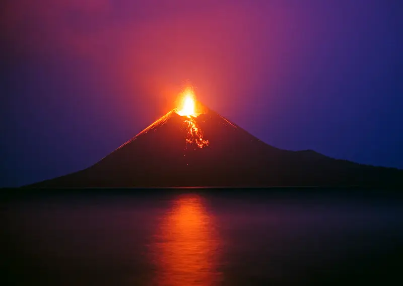
Subduction-zone magma is very different from that of Hawaii or Iceland. It is rich in silica, and therefore viscous, and rich in gas, especially water vapour, the very water that gave birth to it.
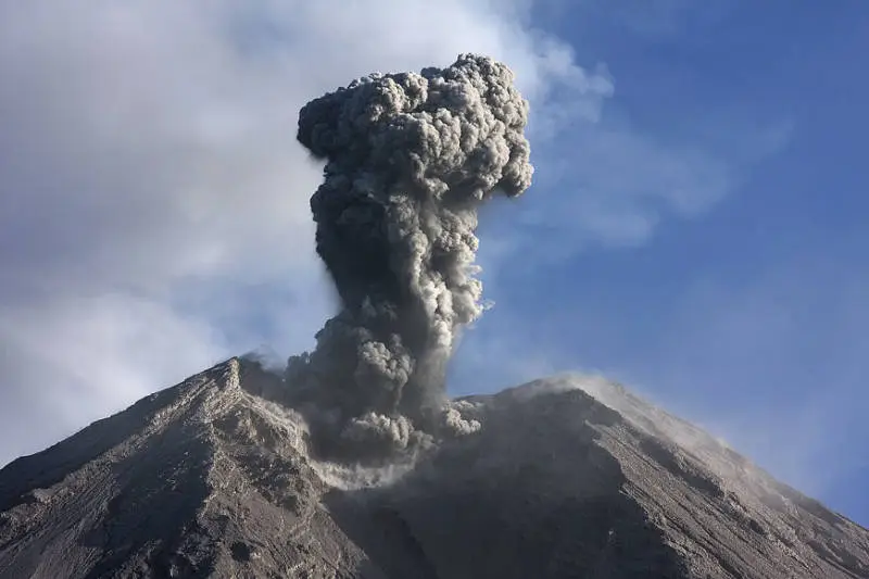
As this magma rises, the gases expand, like in a bottle of soda being opened. But the viscosity stops them escaping. Pressure builds until the magma suddenly shatters: this is the explosive eruption. That is why Indonesian volcanoes are "grey volcanoes", producing mainly ash, blocks and pyroclastic flows, rather than "red volcanoes" with fluid lava flows.
What subduction volcanoes produce
Stratovolcanoes
Layers of ash, scoria and viscous lava pile up into steep-sided cones: stratovolcanoes. Semeru, Merapi, Agung, Inerie and Raung are perfect examples.
Lava domes
When magma is too viscous to flow, it piles up at the summit into a dome that grows slowly. Merapi is the most studied dome volcano in the world; Semeru and Kelud have produced them too.
Pyroclastic flows
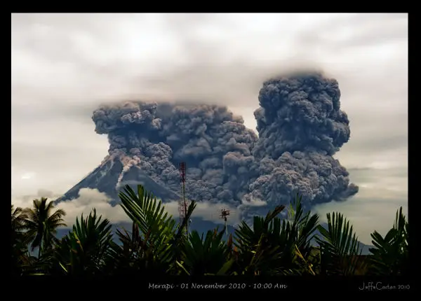
When a dome collapses or an eruption column falls back, a mixture of hot gas, ash and blocks forms and races down the slopes at more than 100 km/h, at several hundred degrees. These are pyroclastic flows (awan panas in Indonesian, "hot clouds"). They killed on Merapi in 1930, 1994 and 2010, and on Semeru in 2021.
Ash plumes
Explosions throw ash kilometres high. It falls back on towns and crops and paralyses air traffic: Agung in 2017, Raung in 2015 and Sangeang Api in 2014 closed the airports of Bali or Darwin.
Lahars
In the rainy season, water remobilises the ash on the slopes and forms lahars, mudflows that pour down the rivers with the consistency of wet concrete. They can strike months or years after an eruption. The word lahar is Javanese.
Calderas
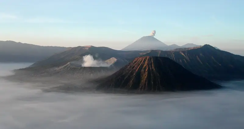
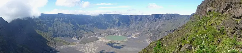
When a magma chamber empties suddenly in a very large eruption, the volcano collapses into the void and forms a caldera. Tengger (Bromo), Ijen, Samalas (Rinjani), Krakatau and Tambora were born this way. The largest in Indonesia is Toba, in Sumatra, 100 km long.
Hydrothermal activity
Groundwater heated by magma feeds fumaroles, solfataras, acid lakes (Kawah Ijen), phreatic explosions (Bromo, Dieng, Papandayan) and toxic gas emissions (Dieng). It is also a resource: Indonesia is one of the world's leading producers of geothermal electricity.
The great Indonesian eruptions
| Eruption | Date | Explosivity index | What remains |
|---|---|---|---|
| Toba (Sumatra) | about 74,000 years ago | 8 | Lake Toba, 100 × 30 km, the largest eruption of the last 100,000 years |
| Samalas (Lombok) | 1257 | 7 | The Rinjani caldera and Lake Segara Anak |
| Tambora (Sumbawa) | 1815 | 7 | A 6 km caldera; the "year without a summer" of 1816 |
| Krakatau (Sunda Strait) | 1883 | 6 | The submarine caldera, Anak Krakatau |
| Agung (Bali) | 1963 | 5 | A measurable global cooling |
| Merapi (Central Java) | 2010 | 4 | Merapi's strongest eruption since 1872 |
The Volcanic Explosivity Index (VEI) runs from 0 to 8; each step corresponds to roughly ten times more material.
How Indonesia monitors its volcanoes
The PVMBG (Centre for Volcanology and Geological Hazard Mitigation), part of the Geological Agency, monitors the country's active volcanoes from more than seventy observatories. Seismographs, tiltmeters, GPS, cameras, gas measurements and satellite images feed reports published several times a day on the MAGMA Indonesia portal.
Each volcano has an alert level:
| Level | Name | Meaning |
|---|---|---|
| I | Normal | Background activity |
| II | Waspada (watch) | Above-normal activity; exclusion zone around the crater |
| III | Siaga (alert) | Eruption possible or under way; wider exclusion zone |
| IV | Awas (danger) | Dangerous eruption under way or imminent; evacuations |
Today's status for all the volcanoes we run is on our Volcano status page.
Frequently asked questions
How many active volcanoes are there in Indonesia?
About 127 volcanoes are considered active, and the PVMBG monitors nearly 70 of them continuously. It is the country with the most active volcanoes in the world.
Why does Java have so many volcanoes?
Because it sits right above the zone where the Indo-Australian plate reaches 100 km depth beneath Eurasia. Java's volcanoes line up along the whole island, about 200 to 300 km north of the trench.
Are Indonesian volcanoes part of the Ring of Fire?
Yes. The Sunda arc is one of the most active segments of the Pacific Ring of Fire, which circles the Pacific with volcanoes and earthquakes linked to subduction.
Does subduction also cause earthquakes?
Yes. Friction between the two plates causes the region's great earthquakes and tsunamis, such as the Sumatra earthquake of December 2004.
Sources
- Smithsonian Institution, Global Volcanism Program
- MAGMA Indonesia (PVMBG)
- Our former article on subduction volcanism (2018, in French)
Article updated on 16 November 2026