Why Penanggungan
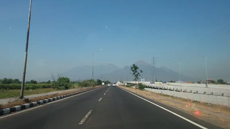
Seen from the Surabaya–Malang toll road, Penanggungan is an almost perfect pyramid ringed by four smaller peaks. The Javanese of the Hindu-Buddhist era saw in it a replica of Mount Meru with its four secondary peaks, and called it Pawitra, "the pure one". For six centuries they covered its slopes with terraced shrines, altars, hermit caves and bathing pools. Archaeologists have listed more than a hundred of them.
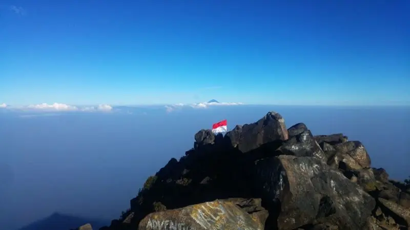
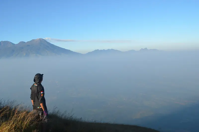
Today you can climb Penanggungan in three hours for a sunrise over Arjuno and Welirang, or go up slowly by the temple route, from shrine to shrine. It is the perfect climb for half a day, a first volcano, or a journey into Java's past.
Penanggungan at a glance
| Elevation | 1,653 m |
|---|---|
| Type | Small stratovolcano, considered extinct for at least a thousand years |
| Last eruption | Perhaps around AD 200 (unconfirmed) |
| Archaeological sites | More than a hundred shrines and remains, dated 977 to 1511 |
| Routes | Tamiajeng (Trawas), Jolotundo, Kedungudi, Kunjorowesi (Ngoro) |
| Time | 3 to 4 hours up; there and back in a day, or a night at the summit |
| Difficulty | Moderate; very steep and shadeless near the top |
| Monitoring | Not monitored by the PVMBG |
Is Penanggungan open?
The box next to this article gives today's status. Penanggungan is open most of the year, but closes temporarily when there are forest fires in the dry season. We found no recent announcement.
When to go
From May to September, ideally on a weekday. The climb is very exposed to the sun: go up at night for sunrise or very early in the morning. At weekends, hundreds of young people from Surabaya camp at the summit.
Getting there
Penanggungan lies between Mojokerto and Pasuruan, about 1 hour from Surabaya airport and 1 h 30 from Malang. The routes start from small villages around Trawas and Ngoro. By public transport, take a bus to Pandaan, then a minibus or motorbike taxi to the trailhead.
The routes
Tamiajeng, the direct route
The busiest route starts from the village of Tamiajeng (Trawas). The trail passes four posts, through forest and then up an increasingly steep slope, to Puncak Bayangan ("the false summit"), a flat area where people camp. The last hour to the summit is steep, on stones that roll underfoot. Allow 3 to 4 hours up.
Jolotundo, the temple route
From the sacred pool of Jolotundo, a route climbs past several terraced shrines: Candi Bayi, Candi Putri, Candi Pura, Candi Gentong, Candi Sinta, Candi Yudha, Candi Wisnu and Candi Kendalisodo, the last carved into the rock with reliefs telling the story of Panji. It is the longest and richest route. You need a guide who knows the sites.
Kedungudi and Kunjorowesi
Two quieter, wilder routes, to the south-west and north.
Map and GPX track
- Tamiajeng → sommet du PenanggunganDistance 2.1 km · Elevation gain 799 m · Start 811 m → High point 1,623 mDownload the GPX track ↓
Indicative route from OpenStreetMap; elevations from Copernicus. Check on the ground and follow your guide. © OpenStreetMap, OpenTopoMap (CC-BY-SA), Open-Meteo.
Jolotundo and Belahan, the sacred pools
At the foot of Penanggungan, two bathing pools are among the finest ancient monuments of Java:
- Petirtaan Jolotundo, on the west flank, dates from 977. A pure spring gushes from carved spouts into a large stone basin; its water is said to be among the purest in Java, and pilgrims come to bathe in it.
- Petirtaan Belahan, on the east flank, is associated with King Airlangga (11th century). The water flows from the breasts of two statues of goddesses, Sri and Lakshmi.
The legend: the top of Mahameru
According to the Tantu Pagelaran, a 15th-century Javanese text, when the gods carried Mount Meru from India to Java to steady the island, they first set it down in the west. Java tipped over. As they moved it east, pieces broke off and became the volcanoes of Java. The top of Meru, broken off, became Penanggungan, while the rest of the mountain is Semeru. Hence the sacred nature of this small mountain.
How much does it cost?
The entrance fee is modest and is paid at the registration post of each route. A guide is not needed on the Tamiajeng route, but it is to understand the temple route.
We organise Penanggungan on request, as a day trip from Tumpang, Malang or Surabaya, by the Tamiajeng route or the Jolotundo temple route. It pairs well with its neighbour Arjuno-Welirang, which shares its sacred history. Request a quote.
History
Inscriptions and monuments date religious activity on Penanggungan from 977 to 1511, from the era of the kings of East Java to the end of Majapahit. Hermits and priests lived in caves and shrines. After Java converted to Islam, the mountain was abandoned and the forest covered the ruins. Dutch archaeologists rediscovered them in the early 20th century, and recent surveys keep finding new ones.
The volcano
Penanggungan is a small stratovolcano just north of the Arjuno-Welirang massif. Lava flows run down its flanks on all sides, and pyroclastic-flow deposits form an apron around its base. The geologist van Bemmelen considered it of comparable age to Arjuno-Welirang and Semeru. It is thought to have been extinct for at least a thousand years; its last eruption may date from around AD 200, without certainty.
Full timeline: 1 recorded eruptions
| Start | End | VEI | Location |
|---|---|---|---|
| 200 (uncertain) | ? | – |
Source: Smithsonian Institution, Global Volcanism Program. VEI = Volcanic Explosivity Index, from 0 (effusive) to 8 (supervolcano); each step means ten times more material.
Frequently asked questions
How long does Penanggungan take?
Three to four hours up via Tamiajeng, two to three down. Half a day to a full day in all, more if you visit the temples.
Is Penanggungan difficult?
Moderately. The last stretch, very steep and without shade, is hard in the heat. At night or early in the morning it is within reach of any regular walker.
Can you camp at the summit?
Yes, at Puncak Bayangan or at the top, but it is crowded at weekends.
Can you see the temples without climbing to the summit?
Yes: Jolotundo and Belahan can be reached by car, and the first shrines of the Jolotundo route are an hour's walk away.
Sources
- Smithsonian Institution, Global Volcanism Program, Penanggungan (263291)
- Our former Penanggungan guide (2019)
Article updated on 16 November 2026