Why Rinjani
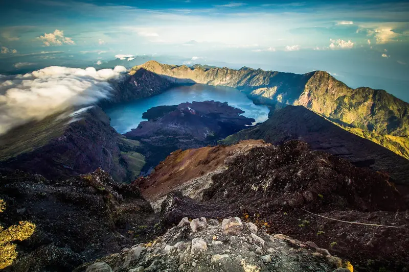
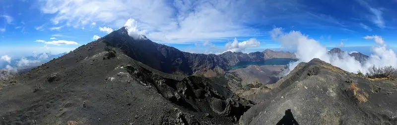
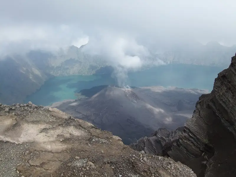
Rinjani is a dream trek that has everything: a summit at 3,726 m from which you can see Bali, Sumbawa and sometimes Tambora; a 6 × 8.5 km caldera holding the deep blue lake Segara Anak ("child of the sea"); in the middle of the lake a small black volcano, Barujari, which steams and poured lava into the water a few years ago; hot springs on the lake shore to soak in after the descent; and nights on the caldera rim above a sea of clouds.
It is also a mountain of history. The caldera was born in 1257, in the eruption of Samalas, one of the most powerful of the last millennia, which cooled the global climate and whose source was only identified in 2013.
Rinjani is not a stroll: three days, 2,500 m of ascent, a final climb in scoria reminiscent of Semeru. But it is one of the most complete volcano treks on the planet.
Rinjani at a glance
| Elevation | 3,726 m, Indonesia's second-highest volcano after Kerinci |
|---|---|
| Caldera | Segara Anak (Samalas), 6 × 8.5 km, formed in 1257 |
| Lake | Segara Anak, about 2,000 m elevation, 230 m deep |
| Active cone | Barujari, inside the caldera |
| Management | Mount Rinjani National Park (Balai TNGR) |
| Main routes | Sembalun (east), Senaru (north), Torean, Timbanuh, Aik Berik, Tetebatu |
| Time | 2 days (lake or summit only) to 4 days (full traverse) |
| Difficulty | Hard: 2,500 m of ascent, final climb in scoria |
| Season | Open April to December; closed every year from January to March |
Is Rinjani open?
The box next to this article gives today's status. The 2026 context:
- Alert level: Rinjani is at level II (Waspada). The PVMBG forbids camping or moving on the Barujari cone and within 1.5 km of its crater. Climbing to the summit and visiting the lake are allowed.
- 2026 season: reopened on 1 April after the annual closure from January to March.
- Fires: in early September 2026, online booking was suspended because of the fire risk. The Senaru route reopened on 3 October 2026, then the other routes.
- Accidents: after a Brazilian hiker's fatal fall near the summit in June 2025, and further accidents in 2026, the park tightened its rules.
Rinjani's rules in 2026
Rinjani is now one of the most regulated volcanoes in Indonesia:
- Compulsory booking on the eRinjani app or website, with daily quotas per route.
- A licensed agency is compulsory for foreigners: you can no longer do Rinjani independently. Since 2026, one guide for at most four hikers.
- A recent medical certificate and specific insurance, compulsory since 1 January 2026.
- Entrance fee: about 250,000 IDR (≈ 13 €) per day per person for a foreigner, according to Lombok agencies (amount to confirm with the park).
- Rubbish: counted in and out, with a fine if any is missing.
- Annual closure from 1 January to 31 March.
When to go
- April–May: end of the rains, green landscapes, fewer people.
- June–August: the best weather but high season, with crowded camps on the Sembalun rim.
- September–October: clear skies but a risk of fire and closure.
- November–December: start of the rains, slippery trails.
At night it is close to 0 °C on the caldera rim (2,640 m) and often below at the summit at dawn, with a lot of wind.
Getting to Rinjani
Lombok is reached by plane (Praya international airport), by fast boat from Bali (Padang Bai or Serangan, 2 to 3 hours) or by slow ferry (Padang Bai – Lembar, 4 to 5 hours). From the airport allow 2 h 30 to 3 hours by road to Sembalun or Senaru. Agencies usually pick their clients up at their hotel on Lombok or the Gili Islands.
The routes
Sembalun, the summit route
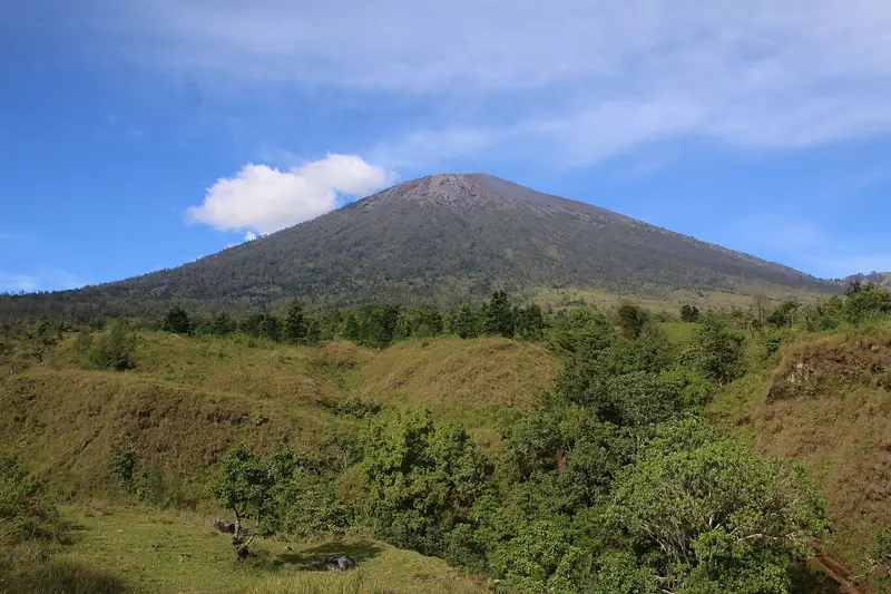
The village of Sembalun (1,150 m), in a farming valley to the east, is the most practical starting point for the summit. The trail first crosses a long sun-exposed savannah, then climbs a series of steep hills, the "hills of regret" (Bukit Penyesalan), to the Plawangan Sembalun camp (2,640 m) on the caldera rim. Allow 7 to 9 hours.
The next day you leave around 2 am for the summit: about 1,100 m of ascent, including a long, very slippery scoria ridge and a final 40-degree slope. Three to four hours up to arrive at sunrise. It is near the summit, on this ridge, that most accidents happen.
Senaru, the forest and lake route
The village of Senaru (600 m), to the north, among forest and waterfalls (Sendang Gile, Tiu Kelep), leads to the rim at Plawangan Senaru (2,640 m) through magnificent rainforest and a continuous climb. From there a steep path drops to Lake Segara Anak. It is the classic descent route for traverses.
The lake and hot springs
Lake Segara Anak lies at about 2,000 m. You camp there, fish (the Sasak catch carp and tilapia), and bathe in the Aik Kalak hot springs, a few minutes from the shore. It is a sacred place for the Sasak and for Lombok's Balinese Hindus, who hold the Pakelem ceremony there, throwing offerings into the lake.
The traverses
- 2 days / 1 night: Sembalun → rim → summit → back, or Senaru → rim → back. Doable but exhausting.
- 3 days / 2 nights: Sembalun → rim → summit → lake → Senaru rim → Senaru. The classic.
- 4 days / 3 nights: the same with a night at the lake. The most comfortable.
The Torean (spectacular, in a canyon, very often closed), Timbanuh, Aik Berik and Tetebatu routes are wilder and less used.
Map and GPX track
- Sembalun → Plawangan Sembalun → sommetDistance 16.7 km · Elevation gain 3,158 m · Start 696 m → High point 3,664 mDownload the GPX track ↓
Indicative route from OpenStreetMap; elevations from Copernicus. Check on the ground and follow your guide. © OpenStreetMap, OpenTopoMap (CC-BY-SA), Open-Meteo.
How much does Rinjani cost?
The entrance fee is around 250,000 IDR (≈ 13 €) per day per person for a foreigner. But most of the budget goes to the compulsory licensed agency: guide, porters, tents, meals, transport. Prices vary a lot with the quality of the gear, the number of porters and group size. Beware of very cheap offers: they often come at the expense of porters and safety.
We do not run Rinjani trips. If you are looking for a big multi-day volcano trek, see our 3-day Semeru or the Arjuno-Welirang traverse, in East Java.
The history of the climb
For the Sasak, the people of Lombok, and for followers of Wetu Telu, a syncretic religion unique to the island, Rinjani is the home of Dewi Anjani, a queen of spirits who rules the mountain. Pilgrims have climbed to the lake for centuries, before the full moon, to pray and purify themselves.
The first European accounts date from the Dutch colonial era. In the 20th century Rinjani became the summit most coveted by Indonesian climbers after Kerinci. The national park was created in 1997. In the 2000s the trek turned into a real economy for the villages of Senaru and Sembalun, where thousands of porters carry everything the camps need on their shoulders, in two baskets at the ends of a pole. In 2018 Rinjani and Lombok were recognised as a UNESCO Global Geopark.
On 29 July 2018 a magnitude 6.4 earthquake set off rockfalls on the trails: hikers were killed and more than 500 evacuated. The magnitude 6.9 earthquake of 5 August 2018 devastated northern Lombok. The routes were closed for months.
The volcano: Samalas and the caldera
Before the 13th century there were two large volcanoes side by side on Lombok: Rinjani and Samalas, perhaps even higher. In 1257 Samalas exploded in one of the largest eruptions of the last millennia (VEI 7). The volcano collapsed, forming the Segara Anak caldera. Pyroclastic flows buried the town of Pamatan, capital of a Lombok kingdom, mentioned in the Babad Lombok, chronicles written on palm leaves.
For a long time scientists found in the ice of Greenland and Antarctica the trace of a gigantic eruption around 1257, without knowing its source. In 2013 a French-Indonesian team led by Franck Lavigne showed, by combining geological deposits, dating and the Babad Lombok, that it was Samalas.
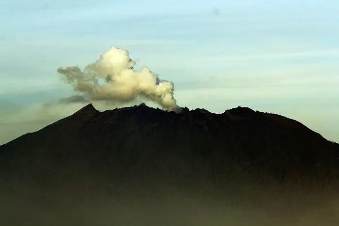
After the collapse a new cone was born in the caldera: Barujari ("the new finger"), whose lava flows push out into the lake. It is the one active today. The summit of Rinjani is the old cone that survived on the east side of the caldera.
The eruptions of Rinjani
The Smithsonian records 21 eruptions, all at Barujari since 1846, except that of Samalas in 1257.
1257. Eruption of Samalas (VEI 7), birth of the caldera.
1846-1915. Moderate explosions at Barujari.
1944-1966. Lava flows north-west of Barujari, including the Rombongan flow, which entered the lake.
1994. An explosion (VEI 3); lahars killed villagers who were collecting holy water near the lake.
2004, 2009-2010. Lava flows into the lake from Barujari's north-east flank.
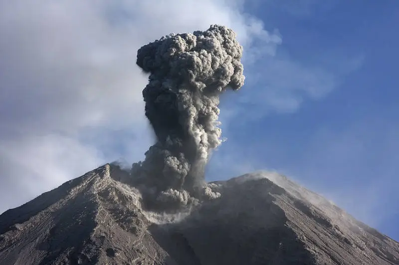
2015-2016. Ash plumes several kilometres high; Lombok airport and sometimes Bali's closed; hundreds of hikers evacuated in September 2016.
2026. Level II, volcanic earthquakes and tremor; no eruption.
Full timeline: 21 recorded eruptions
| Start | End | VEI | Location |
|---|---|---|---|
| 2016-08-01 | 2016-09-27 | 2 | Barujari Crater |
| 2015-10-25 | 2015-12-24 | 2 | Barujari crater |
| 2009-05-02 | 2010-05-23 | 2 | NE flank of Gunung Barujari |
| 2004-10-01 | 2004-10-05 | 2 | Summit and NE flank of Barujari |
| 1995-09-12 (uncertain) | ? | – | |
| 1994-06-03 | 1994-11-21 | 3 | Gunung Barujari |
| 1966-03-28 | 1966-08-08 | 1 | East side of Barujari (2250 m) |
| 1965-09-16 | ? | 0 | Gunung Barujari |
| 1953-10-15 | ? | 0 | Gunung Barujari |
| 1949-07-02 | 1950-07-02 | 0 | NW flank of Gunung Barujari |
| 1944-12-25 | 1945-01-01 | 2 | NW flank of Barujari (Rombongan) |
| 1941-05-30 (uncertain) | ? | – | Rinjani summit |
| 1915-11-04 | ? | 2 | Gunung Barujari (Segara Munjar) |
| 1909-11-30 | 1909-12-02 | 2 | Gunung Barujari |
| 1906-04-29 | ? | 1 | Gunung Barujari |
| 1901-06-01 | 1901-06-02 | 2 | Gunung Barujari |
| 1900-11-30 | 1900-12-02 | 2 | Gunung Barujari |
| 1884-08-08 | 1884-08-10 | 2 | Gunung Barujari |
| 1846-09-10 | 1846-09-12 | 2 | Gunung Barujari |
| 1257-07-01 | ? | 7 | Samalas |
| 600 BCE | ? | – |
Source: Smithsonian Institution, Global Volcanism Program. VEI = Volcanic Explosivity Index, from 0 (effusive) to 8 (supervolcano); each step means ten times more material.
How Rinjani is monitored
The PVMBG observatory in Sembalun monitors the volcano continuously. The daily reports on MAGMA Indonesia are the reference; the one of 15 November 2026 records a gas explosion, an episode of tremor and a deep volcanic earthquake.
Frequently asked questions
How many days does Rinjani take?
Three days and two nights for the classic Sembalun – summit – lake – Senaru traverse. Two days for the summit or the lake alone, four to do it comfortably.
Can you do Rinjani without an agency?
Not any more for a foreigner: you must go through a licensed agency, with one guide for at most four hikers, and book on eRinjani.
Is Rinjani difficult?
Yes. The climb from Sembalun to the rim takes 7 to 9 hours, and the summit climb is done at night in slippery scoria, at 40 degrees near the end. You need to be fit and used to mountains.
When is Rinjani closed?
Every year from 1 January to 31 March, and occasionally for fires, earthquakes or volcanic activity.
Can you swim in the lake?
In the lake it is possible but cold, and it is a sacred place. The Aik Kalak hot springs, right next to it, are made for that.
Rinjani or Semeru?
Rinjani is longer, more varied (lake, hot springs, caldera) and busier. Semeru offers a volcano in permanent eruption and a shorter trek. Both have a very hard final climb in volcanic sand.
Is Rinjani dangerous?
Accidents happen mostly on the summit ridge (falls) and from the cold. The volcano itself is monitored, and Barujari is off limits. Follow your guide, take winter clothes and stay away from the edges.
Sources
- MAGMA Indonesia (PVMBG), Rinjani activity report of 15 November 2026
- Smithsonian Institution, Global Volcanism Program, Rinjani (264030)
- Balai Taman Nasional Gunung Rinjani; RRI (park rules); Antara (limited reopening), Antara (Senaru reopening) and Katadata (five routes reopened, October 2026)
- Lavigne F. et al., "Source of the great A.D. 1257 mystery eruption unveiled, Samalas volcano, Rinjani Volcanic Complex, Indonesia", PNAS, 2013
Article updated on 16 November 2026