Why Merapi
Merapi means "mountain of fire" in Javanese, and the name does not lie. With more than a hundred recorded eruptions, Merapi is one of the most active volcanoes in the world, and surely the most dangerous in Java: it looms directly over the city of Yogyakarta and some of the most densely populated rice plains on the planet.
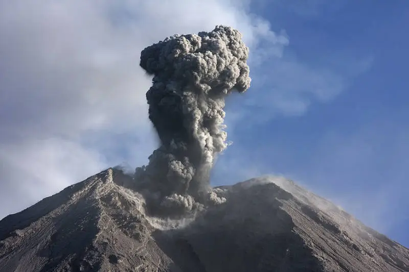
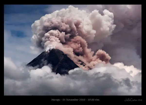
What fascinates at Merapi is that you see volcanism at work. At the summit, a lava dome grows by a few thousand cubic metres a day. When it becomes unstable, whole sections collapse and turn into pyroclastic flows (awan panas), avalanches of gas and rock at several hundred degrees that race down the valleys at more than 100 km/h. Volcanologists worldwide even call them "Merapi-type" flows.
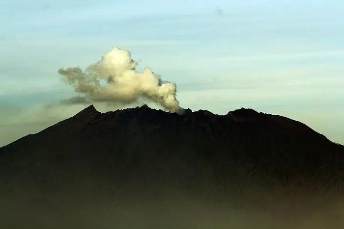
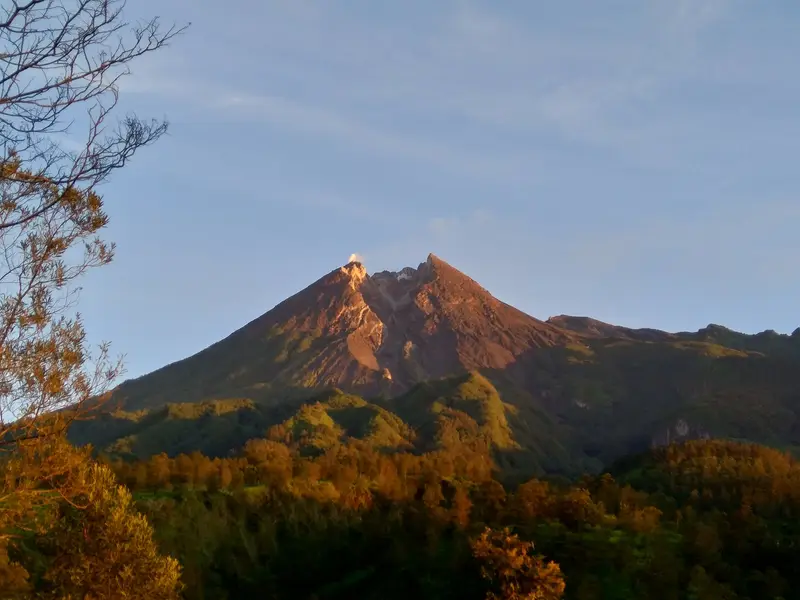
Merapi is also a sacred mountain, bound to the palace of the Sultan of Yogyakarta by a spiritual pact; villages buried in 2010 and turned into museums; and one of the finest views in Java, when you watch it steam at sunrise from its neighbour Merbabu.
Merapi has not been climbed for several years. But you can approach it, understand it and watch it live. That is what this guide is about.
Merapi at a glance
| Elevation | 2,968 m according to the PVMBG (varies as the dome grows) |
|---|---|
| Type | Andesitic stratovolcano with a lava dome |
| Activity | Dome growth, lava avalanches and pyroclastic flows, almost continuously |
| Eruptions | 112 recorded by the Smithsonian; the last major one in 2010 (VEI 4) |
| Location | Between Yogyakarta, Magelang, Boyolali and Klaten; 28 km from central Yogyakarta |
| Management | Mount Merapi National Park (Taman Nasional Gunung Merapi); BPPTKG monitoring |
| Alert level | III (Siaga) since 5 November 2020 |
| Climb | Forbidden beyond the lower posts while level III is in force |
Can Merapi be climbed today?
No. The box next to this article gives today's status.
Merapi has been at level III (Siaga) since 5 November 2020. A new lava dome formed at the end of 2020, then a second one, and activity has not stopped since. The MAGMA report of 16 November 2026 still records four lava avalanches towards the Sat/Putih river, travelling up to two kilometres, and 21 avalanche earthquakes in six hours.
The PVMBG has defined danger zones: up to 5 km along the Boyong river and 7 km along the Bedog, Krasak and Bebeng rivers to the south-west, 3 km along the Woro and 5 km along the Gendol to the south-east, and a 3 km radius around the summit in case of explosion. The summit is therefore off limits, and the Selo route is closed.
How to see Merapi when you cannot climb it
The Kaliurang Lava Tour
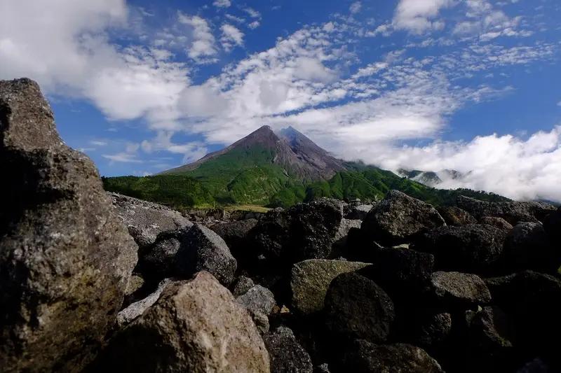
On the south flank, above Yogyakarta, village cooperatives run jeep tours through the areas devastated by the 2010 eruption. You visit the Museum Sisa Hartaku ("the remains of my belongings"), a buried house displaying stopped clocks and cow skeletons; the Kaliadem bunker, where two rescuers died in 2006; the rock known as Batu Alien; and the destroyed house of Mbah Maridjan, the volcano's spiritual guardian. The jeeps cross lahar beds. It is both tourism and a memorial.
These tours stay outside the danger zones, but can be suspended when activity increases.
The viewpoints
- Bukit Klangon and Kali Kuning, on the south flank, to see the dome and, with luck, a lava avalanche at dawn.
- Ketep Pass, to the north-west, between Merapi and Merbabu, with a small volcano museum and binoculars.
- Jurang Jero and Stonehenge Merapi, on the Kaliurang side.
- The summit of Merbabu, right opposite: the finest view of Merapi, provided you spend the night on the mountain. See the Merbabu guide.
At night, when the sky is clear, you can make out from the northern viewpoints the red glow of incandescent avalanches on the flank.
The Merapi climb, when it was open
It is worth knowing how Merapi used to be climbed, because the route may reopen one day.
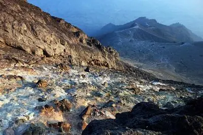
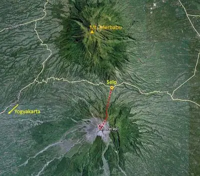
The classic route started from Selo (about 1,600 m), a village of vegetable growers to the north, on the saddle between Merapi and Merbabu. You left at midnight from the New Selo post. The trail climbed steeply through forest, then over rocks and scoria, to Pasar Bubrah (about 2,600 m), a plateau of boulders where people camped. The last section, very steep and loose, led in an hour to the crater rim, facing the steaming dome. Allow 4 to 5 hours up and 3 hours down.
The route was closed on 11 May 2018, when a phreatic explosion threw up a 5,500 m ash column while hikers were on the mountain. The level III of 2020 closed it for a long time.
Map and GPX track
- New Selo → Pasar Bubrah → sommetDistance 3 km · Elevation gain 1,072 m · Start 1,782 m → High point 2,872 mDownload the GPX track ↓
Indicative route from OpenStreetMap; elevations from Copernicus. Check on the ground and follow your guide. © OpenStreetMap, OpenTopoMap (CC-BY-SA), Open-Meteo.
When to go
The Lava Tour and viewpoints can be visited all year. The dry season (May to October) offers the clearest mornings. In the rainy season, lahars, mudflows that remobilise the ash, are a real danger in the rivers coming down from the volcano: tours may be suspended after heavy rain.
Getting there
Merapi is visited from Yogyakarta, 45 minutes to an hour from Kaliurang. Yogyakarta has an international airport and trains from Jakarta, Surabaya and Malang. You can also approach it from Magelang (next to Borobudur), Boyolali (Selo) or Klaten.
The history of climbing Merapi
The first people to go up Merapi did so to pray, not to climb. For the Javanese, the volcano is inhabited by a kingdom of spirits, the Keraton Merapi, a supernatural mirror of the Sultan of Yogyakarta's palace. Every year, during the Labuhan Merapi ceremony, envoys from the palace climb to lay offerings on its slopes. A juru kunci, "keeper of the keys", appointed by the sultan, is responsible for dialogue with the mountain.
The most famous was Mbah Maridjan, guardian from 1982 until his death. In 2006 he refused to evacuate and Merapi spared him, which made him a national celebrity. On 26 October 2010 he again refused to leave his house in Kinahrejo. The first pyroclastic flow of the great eruption killed him there, along with more than a dozen villagers and volunteers who had come to persuade him.
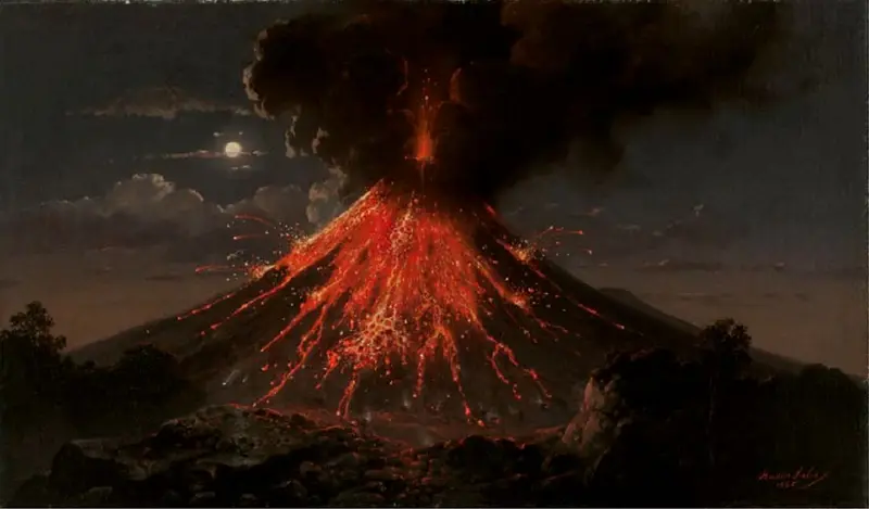
Colonial-era naturalists climbed and described Merapi from the 19th century: Franz Wilhelm Junghuhn drew its summit. In the 20th century the Selo route became one of the most popular climbs in Central Java, until it closed in 2018.
The volcano: how Merapi works
Merapi is the youngest and southernmost of a chain of volcanoes stretching north-north-west to Ungaran. It is made of two edifices. Old Merapi, Pleistocene, collapsed perhaps 2,000 years ago, leaving a large arc-shaped scarp. Young Merapi, with steep slopes and a bare summit, was built south-west of that scar.
Its andesitic magma is very viscous. Instead of flowing, the lava piles up at the summit into a dome. When the dome grows on a steep slope it becomes unstable; blocks break away, shatter as they fall and form collapse pyroclastic flows. More rarely, as in 2010, gas pressure causes true explosions, which send pyroclastic flows much further.
The eruptions of Merapi
The Smithsonian records 112 eruptions of Merapi, from 8780 BCE to the present. Here are the most significant.
Around AD 1000. A popular tradition blames Merapi for the Mataram kingdom's abandonment of Central Java and for Borobudur's burial under ash. Geologists still debate it.
1672. One of the deadliest of the colonial era, with thousands of victims according to the chronicles.
1872. The strongest historical eruption before 2010 (VEI 4): pyroclastic flows on several flanks.
1930. Pyroclastic flows reach the western villages: about 1,370 dead.
1961, 1969, 1984. Phases of domes and pyroclastic flows, with victims and thousands evacuated.
22 November 1994. A pyroclastic flow descends on the village of Turgo during a wedding ceremony: 66 dead.
2006. Dome growth and pyroclastic flows; the same month an earthquake devastates Yogyakarta. Two rescuers die in the Kaliadem bunker.
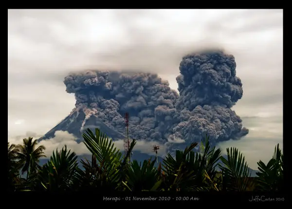
October–November 2010. The strongest eruption since 1872 (VEI 4). After weeks of warning signs, the volcano exploded on 26 October, then even more violently on 5 November: pyroclastic flows travelled up to 15 km down the Gendol valley. About 350 dead, more than 350,000 evacuated, Yogyakarta airport closed. Without the evacuation ordered by the volcanologists, the toll would have been far heavier.
2013-2014. Sudden phreatic explosions, including that of March 2014.
11 May 2018. A phreatic explosion with hikers on the mountain: the Selo route closes.
Since November 2020. A new dome, pyroclastic flows and lava avalanches almost daily. Level III has been maintained for more than six years.
Full timeline: 112 recorded eruptions
| Start | End | VEI | Location |
|---|---|---|---|
| 2020-12-31 | 2026-03-25 | 1 | |
| 2018-05-11 | 2020-06-21 | 3 | Summit crater |
| 2014-03-09 | 2014-04-20 | 3 | Summit crater |
| 2013-11-18 | 2013-11-18 | 3 | Summit crater |
| 2013-07-22 | 2013-07-22 | 1 | Summit crater |
| 2011-03-25 | 2011-09-08 | 1 | Summit crater |
| 2010-10-26 | 2010-11-29 | 4 | Summit crater |
| 2008-05-19 (uncertain) | ? | – | |
| 2006-03-16 | 2007-08-09 | 1 | |
| 1992-01-20 | 2002-10-19 | 2 | NW of 1984 lava dome |
| 1986-10-10 | 1990-08-16 | 2 | |
| 1972-10-06 | 1985-03-16 | 2 | |
| 1971-01-16 (uncertain) | 1971-07-26 | 1 | |
| 1967-01-12 | 1970-07-02 | 2 | Upper Batang breach (2600 m) |
| 1961-04-11 | 1961-11-28 | 3 | |
| 1953-03-02 | 1958-12-16 | 2 | |
| 1948-09-29 | 1948-12-16 | 2 | |
| 1942-05-30 | 1945-05-16 | 2 | |
| 1939-12-13 | 1940-09-16 | 2 | |
| 1933-10-01 | 1935-04-16 | 2 | |
| 1932-11-16 | ? | 1 | |
| 1930-11-25 | 1931-09-16 | 3 | |
| 1924-09-10 | 1924-09-12 | 1 | |
| 1923-09-16 (uncertain) | 1923-11-16 | – | |
| 1922-02-18 | 1922-08-08 | 1 | |
| 1920-07-25 | 1921-02-16 | 2 | |
| 1918-01-16 | ? | 1 | |
| 1915-03-28 | 1915-05-15 | 1 | |
| 1909-02-01 | 1913-05-16 | 1 | West dome |
| 1908-07-16 | ? | 1 | |
| 1906-01-26 | 1907-02-17 | 2 | Summit and upper east flank (2600 m) |
| 1905-01-16 | 1905-06-01 | 2 | |
| 1902-12-16 | 1904-06-20 | 2 | |
| 1902-02-03 | 1902-02-03 | 1 | |
| 1897-07-02 | ? | 2 | |
| 1894-10-16 | ? | 1 | |
| 1894-01-27 | 1894-02-02 | 2 | |
| 1893-10-16 | ? | 1 | |
| 1891-08-25 | 1892-07-02 | 2 | |
| 1889-07-02 | ? | 1 | |
| 1888-08-18 | 1888-12-20 | 2 | |
| 1885-02-24 | 1887-07-02 | 1 | |
| 1883-01-16 | 1884-11-16 | 1 | East dome |
| 1878-07-02 | 1879-06-20 | 2 | |
| 1872-11-03 | 1873-01-16 | 2 | |
| 1872-04-15 | 1872-04-21 | 4 | |
| 1865-10-24 | 1871-08-16 | 2 | |
| 1862-05-26 | 1864-07-02 | 2 | |
| 1861-07-02 | ? | 2 | |
| 1854-09-16 (uncertain) | ? | – | |
| 1849-09-14 | 1849-09-24 | 3 | |
| 1849-04-26 | 1849-04-26 | 2 | |
| 1848-01-08 (uncertain) | ? | – | |
| 1846-09-02 | 1847-10-16 | 3 | Summit and upper SE flank (2600 m) |
| 1846-04-06 | ? | 2 | |
| 1840-01-04 | ? | 1 | |
| 1837-08-10 | 1838-06-16 | 2 | |
| 1832-12-25 | 1836-07-02 | 2 | |
| 1828-12-18 | 1828-12-19 | 2 | |
| 1822-12-27 | 1823-04-06 | 3 | |
| 1812-07-02 | 1822-07-02 | 1 | |
| 1810-07-02 | ? | 1 | |
| 1807-07-02 | ? | 1 | |
| 1797 | ? | 1 | |
| 1791 | ? | 2 | |
| 1786-07-17 | ? | 1 | |
| 1768-08-19 | ? | 2 | |
| 1755 | ? | 2 | |
| 1752 | ? | 2 | |
| 1745 | ? | 2 | |
| 1678-08-19 | ? | 3 | |
| 1677 | ? | 3 | |
| 1672-08-04 | ? | 3 | |
| 1663-12-31 | ? | 3 | |
| 1658 | ? | 3 | |
| 1587 | ? | 3 | |
| 1586 (uncertain) | ? | – | |
| 1584 | ? | 3 | |
| 1560 | ? | 3 | |
| 1554 | ? | 3 | |
| 1548 | ? | 3 | |
| 1480 | ? | – | |
| 1440 | ? | – | |
| 1380 | ? | – | |
| 1300 | ? | – | |
| 1230 | ? | – | |
| 1190 | ? | – | |
| 1140 | ? | – | |
| 1090 | ? | – | |
| 1010 | ? | – | |
| 940 | ? | 3 | |
| 870 | ? | – | |
| 680 | ? | – | |
| 630 | ? | – | |
| 540 | ? | – | |
| 480 | ? | – | |
| 410 | ? | 3 | |
| 280 | ? | – | |
| 190 | ? | – | |
| 120 | ? | – | |
| 20 | ? | 4 | |
| 340 BCE | ? | 3 | |
| 700 BCE | ? | – | |
| 1010 BCE | ? | – | |
| 1180 BCE | ? | 4 | |
| 1410 BCE | ? | – | |
| 1770 BCE | ? | – | |
| 1890 BCE | ? | – | |
| 2910 BCE | ? | – | |
| 4690 BCE | ? | – | |
| 7310 BCE | ? | – | |
| 8780 BCE | ? | – | Old Merapi |
Source: Smithsonian Institution, Global Volcanism Program. VEI = Volcanic Explosivity Index, from 0 (effusive) to 8 (supervolcano); each step means ten times more material.
How Merapi is monitored
Merapi is monitored by the BPPTKG, a specialised PVMBG centre based in Yogyakarta, with observatories all around the volcano (Kaliurang, Babadan, Jrakah, Selo, Ngepos). Seismographs, thermal cameras, drones, deformation and gas measurements track the dome day by day. Reports are published every six hours on MAGMA Indonesia.
Around Merapi
- Borobudur, the largest Buddhist temple in the world, 40 km to the west: the sunrise over Merapi from the hills of Punthuk Setumbu is famous.
- Prambanan, the great 9th-century Hindu temple, to the south-east.
- Merbabu, just to the north: see our guide.
- Yogyakarta, its palaces and batik workshops.
Frequently asked questions
Can Merapi be climbed in 2026?
No. The volcano has been at level III since November 2020, with danger zones up to 7 km from the summit. The Selo route has been closed since 2018.
When will Merapi reopen for climbing?
Nobody knows. The volcano would have to drop to level II, then to level I, and the park would have to reopen the Selo route. Given current activity, it will not be soon.
Is the Lava Tour safe?
It stays outside the danger zones defined by the PVMBG and is suspended when activity increases or after heavy rain. Choose an official Kaliurang operator and follow their instructions.
Where can you see Merapi up close?
From Bukit Klangon and Kali Kuning to the south, Ketep Pass to the north-west, or from the summit of Merbabu, which offers the most spectacular view.
Does Merapi threaten Yogyakarta?
Central Yogyakarta is 28 km from the summit, out of reach of pyroclastic flows. Ash fall and lahars in the rivers that cross the city are the main risks. The villages on the flanks, however, are directly exposed.
Can you see lava at Merapi?
Sometimes at night, from the northern and western viewpoints: the glow of incandescent avalanches rolling down the flank. You do not see fluid lava flows.
What is the difference between Merapi and Marapi?
Merapi is in Central Java. Marapi is another active volcano, in West Sumatra, sadly known for the December 2023 eruption that killed 24 hikers. And there is a third Merapi, the highest point of the Ijen massif in East Java.
Sources
- MAGMA Indonesia (PVMBG), Merapi activity report of 16 November 2026
- Smithsonian Institution, Global Volcanism Program, Merapi (263250)
- BPPTKG Yogyakarta, weekly reports on Merapi
- Our former Merapi climbing guide (2018, in French)
Article updated on 16 November 2026