Why Kerinci
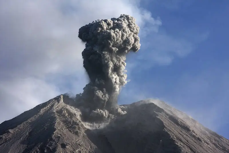
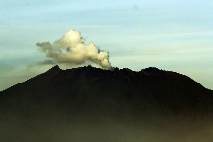
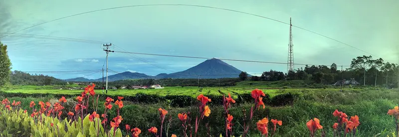
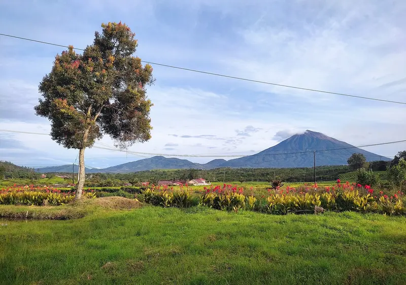
Kerinci is the highest volcano in Indonesia, the highest peak in Sumatra and one of the highest volcanoes in South-East Asia. But it is not just a number. The climb starts from an ocean of tea plantations, crosses one of the finest tropical mountain forests in Indonesia, then comes out onto a bare scoria cone up to a 600 m-wide crater that gives off an almost permanent plume.
The surrounding Kerinci Seblat National Park is the largest in Sumatra and one of the last refuges of the Sumatran tiger. You will not see one, but you walk through its territory, with gibbons calling at dawn.
Kerinci is climbed in two days. It is far, it is muddy, it is cold at the top. It is also one of the great volcano treks of Indonesia.
Kerinci at a glance
| Elevation | 3,805 m, the highest volcano in Indonesia |
|---|---|
| Type | Andesitic stratovolcano, 13 × 25 km at the base |
| Crater | About 600 m wide, often holding a small lake |
| Activity | Frequent moderate explosions and ash plumes; 39 eruptions recorded, the latest in 2024 |
| Management | Kerinci Seblat National Park (UNESCO World Heritage, Tropical Rainforest Heritage of Sumatra) |
| Trailhead | Kersik Tuo (about 1,500 m), Jambi province |
| Time | 2 days / 1 night |
| Difficulty | Hard: 2,300 m of ascent, mud, roots, scoria at the top |
| Alert level | II (Waspada) in November 2026 |
Is Kerinci open?
The box next to this article gives today's status.
- The trails have been closed since 1 September 2026, by decision of the Ministry of Forestry, as part of the closure of nine national parks threatened by fires. The closure covers the Kerinci and Solok Selatan routes. No reopening date had been announced by 16 November.
- The volcano is at level II. The PVMBG forbids going to the crater within a 3 km radius, because of high gas concentrations and the risk of ballistic blocks in a sudden explosion. The MAGMA report of 15 November 2026 records 32 gas explosions and 40 low-frequency earthquakes in 24 hours.
In practice, even when the park reopens, the summit of Kerinci is off limits as long as level II and that radius remain. The climb then stops at the forest camps.
When to go
- May to September: the driest season, clear skies in the morning. The only period really worth recommending.
- October to April: heavy rain, the trail turns into a stream of mud.
At dawn it is around 0 °C at the summit, often with strong wind.
Getting to Kerinci
Kerinci lies in the mountains of western Sumatra, between the provinces of Jambi and West Sumatra.
- From Padang (international airport, flights from Jakarta and Kuala Lumpur): 6 to 8 hours by road along the coast and then into the mountains to Kersik Tuo.
- From Sungai Penuh, the town of the Kerinci valley (small Depati Parbo airport, irregular flights): 1 h 30 to 2 hours by road.
You sleep in Kersik Tuo, a tea growers' village at the foot of the volcano, in simple homestays.
The climb, stage by stage
| Stage | Elevation | Time |
|---|---|---|
| Kersik Tuo → park gate (R10) | 1,500 → 1,800 m | 1 h (often by vehicle) |
| Gate → Shelter 1 | → 2,500 m | 3 h |
| Shelter 1 → Shelter 2 | → 3,000 m | 2 h |
| Shelter 2 → Shelter 3 (camp) | → 3,300 m | 1 h |
| Shelter 3 → summit | → 3,805 m | 2 to 3 h |
The route first crosses the tea plantations, then enters the forest at the park gate. The forest is magnificent and exhausting: roots, mud, slippery earth steps. Above 3,000 m the vegetation thins and the trail becomes a gully. You camp at Shelter 2 or Shelter 3, on cramped ground.
The next day you leave around 3 am for the summit. You leave the vegetation, pass Tugu Yudha, a memorial to a hiker who disappeared in 1990, then climb a slope of scoria and rocks to the crater rim. On a clear day the view takes in the Kerinci valley, Lake Kerinci, the Indian Ocean and the mountains of Sumatra. You get back down to Kersik Tuo the same day.
How much does the climb cost?
You need a Kerinci Seblat National Park permit, a local guide (strongly recommended, sometimes required) and, usually, porters. Guides in Kersik Tuo offer packages including the permit, transport to the gate, tents and meals.
We do not run Kerinci trips. In East Java, Semeru offers a comparable climb, on a volcano in permanent eruption.
Around Kerinci
- Lake Gunung Tujuh, at 1,950 m, the highest caldera lake in South-East Asia, ringed by seven peaks, half a day's walk from the village of Pelompek.
- The Kayu Aro tea plantations, created by the Dutch in the 1920s, among the largest in the world.
- Lake Kerinci and the villages of the valley, with their traditional longhouses.
- The waterfalls of Telun Berasap and the hot springs of Semurup.
The history of Kerinci
The Kerinci, the people of the high valley, call the volcano Gunung Gadang, "the great mountain". Their history is linked to the old kingdoms of Jambi and Minangkabau, and the valley holds prehistoric megaliths.
In colonial times the Dutch entered the Kerinci valley late, at the start of the 20th century. They set up the great Kayu Aro tea plantations there in the 1920s. The first documented ascents were made by explorers and naturalists of that period. Kerinci Seblat National Park was created in 1982 and in 2004 added to the UNESCO World Heritage list, with the Gunung Leuser and Bukit Barisan Selatan parks, as the "Tropical Rainforest Heritage of Sumatra".
The volcano
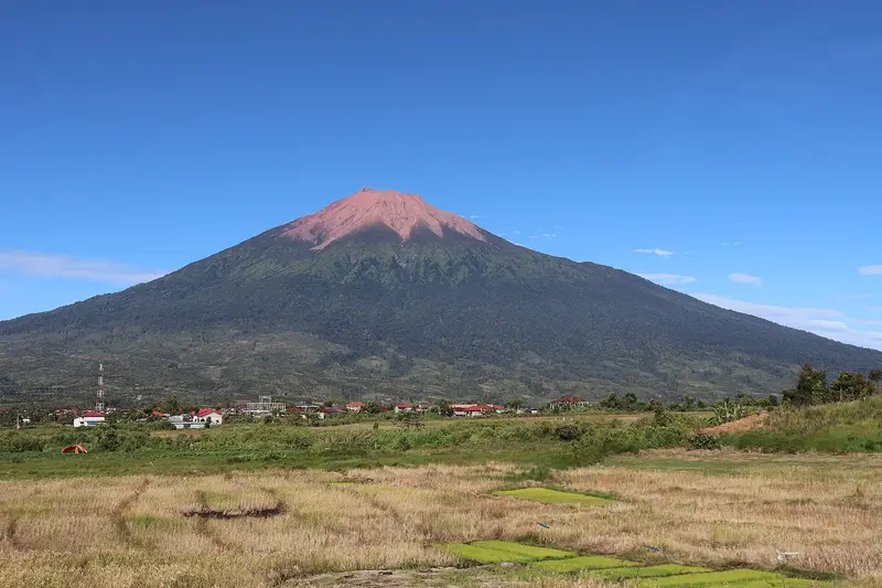
Kerinci is a massive stratovolcano 13 × 25 km across, elongated north to south, rising 2,400 to 3,300 m above the surrounding plains. It is capped by a young, bare scoria cone, built north-east of the remains of an older crater. Its deep summit crater, 600 m wide, often holds a small lake in its north-eastern part. Like all of Sumatra's volcanoes, it is fed by the subduction of the Indo-Australian plate, and it sits close to the great Sumatran fault.
The eruptions of Kerinci
The Smithsonian records 39 eruptions of Kerinci since the first described in 1838. They are almost always moderate explosions (VEI 1 to 2), with ash plumes and ash fall on the valley.
1838-1938. About a dozen moderate explosive eruptions.
1952-1971. A very active phase, almost one eruption a year.
1990-2009. A new series of explosions, including those of 1998-1999 and 2004.
2013, 2016, 2018-2021. Regular ash plumes; the crater grows more and more active.
2022-2024. Repeated ash eruptions; the latest recorded by the Smithsonian dates from May 2024.
2026. Level II, very many gas explosions and low-frequency earthquakes.
Full timeline: 39 recorded eruptions
| Start | End | VEI | Location |
|---|---|---|---|
| 2024-05-28 | 2024-05-28 | 2 | |
| 2022-10-15 | 2023-02-27 | 2 | |
| 2018-04-21 | 2021-06-13 | 1 | Summit crater |
| 2017-08-13 | 2017-08-13 | 1 | Summit crater |
| 2016-11-15 | 2016-11-21 | 1 | Summit crater |
| 2016-03-31 | 2016-06-09 | 2 | Summit crater |
| 2013-06-02 | 2013-06-02 | 2 | Summit crater |
| 2011-12-15 | 2011-12-15 | 1 | Summit crater |
| 2009-04-01 | 2009-06-19 | 1 | |
| 2008-03-24 | ? | 1 | |
| 2007-09-09 | 2007-09-09 | 1 | |
| 2004-06-22 | 2004-10-24 | 2 | |
| 2001-05-12 | 2002-08-27 | 2 | |
| 1999-03-16 | 1999-09-16 | 2 | |
| 1998-11-03 | ? | 2 | |
| 1998-07-04 | 1998-07-04 | 2 | |
| 1996-08-16 | 1996-10-16 | 1 | |
| 1990-12-31 | ? | 2 | |
| 1971-06-16 (uncertain) | 1971-06-16 | 1 | |
| 1969-07-02 | 1970-07-02 | 2 | |
| 1968-02-03 | 1968-03-18 | 2 | |
| 1967-11-02 | ? | 2 | |
| 1966-06-09 | 1966-06-30 | 2 | |
| 1964-07-08 | 1964-07-08 | 2 | |
| 1963-07-16 | ? | 2 | |
| 1960-07-16 | ? | 2 | |
| 1952-01-16 | 1952-06-16 | 2 | |
| 1938-01-19 | 1938-03-18 | 2 | |
| 1937-09-08 | ? | 2 | |
| 1936-08-30 | 1936-08-30 | 2 | |
| 1936-04-29 | 1936-04-29 | 2 | |
| 1923-09-16 | 1923-09-16 | 1 | |
| 1921-05-16 | 1921-06-16 | 2 | |
| 1908-10-16 | 1909-07-02 | 2 | |
| 1887-03-23 | 1887-03-30 | 2 | |
| 1878-12-11 | ? | 2 | |
| 1874-07-02 | ? | 2 | |
| 1842-07-02 | ? | 2 | |
| 1838-07-02 | ? | 2 |
Source: Smithsonian Institution, Global Volcanism Program. VEI = Volcanic Explosivity Index, from 0 (effusive) to 8 (supervolcano); each step means ten times more material.
How Kerinci is monitored
The PVMBG monitors Kerinci from the Kersik Tuo observatory at the foot of the volcano. Daily reports are published on MAGMA Indonesia.
Frequently asked questions
What is the highest volcano in Indonesia?
Kerinci, at 3,805 m, ahead of Rinjani (3,726 m) and Semeru (3,676 m). The country's highest peak, Puncak Jaya in Papua (4,884 m), is not a volcano.
Can Kerinci be climbed in 2026?
The trails have been closed since 1 September 2026 because of fires, and the summit lies within the 3 km exclusion radius of level II. Check the box before you travel.
How long does it take?
Two days and one night for the climb, plus a day of travel from Padang each way.
Is Kerinci difficult?
Yes. More than 2,000 m of ascent, a very muddy forest, a last section in scoria and the cold at the summit.
Can you see tigers?
It is extremely rare. The park is home to one of the last Sumatran tiger populations, but they avoid people. Gibbons and hornbills are much easier to hear.
Sources
- MAGMA Indonesia (PVMBG), Kerinci activity report of 15 November 2026
- Smithsonian Institution, Global Volcanism Program, Kerinci (261170)
- Ministry of Forestry announcement on national park closures (Katadata, 31 August 2026)
- Our former Kerinci guide (2019, in French)
Article updated on 16 November 2026